2015
TQ1889 : Queensbury station
taken 8 years ago, near to Kingsbury, Brent, England
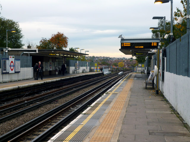
Queensbury station
This station was built by the Metropolitan Railway on their Stanmore branch, but it did not open as early as the other stations on the line as there was, at the time, little development in the area. That soon changed, and the name of the area, Queensbury, was chosen to fit with Kingsbury, the next main settlement. In 1939 when the Bakerloo Line was extended from Baker Street to Finchley Road, it took over the Stanmore branch, so Queensbury became a Bakerloo Line station. But that changed again in 1976 with the coming of the Jubilee Line, which took over that part of the Bakerloo from Baker Street to Stanmore. Jubilee Line trains now operate from Stratford to Stanmore.
 Map © Crown Copyright")
TIP: Click the map for more Large scale mapping
- Grid Square
- TQ1889, 57 images (more nearby 🔍)
- Photographer
- Dr Neil Clifton (more nearby)
- Date Taken
- Friday, 30 October, 2015 (more nearby)
- Submitted
- Saturday, 31 October, 2015
- Subject Location
-
OSGB36:
 TQ 1881 8975 [10m precision]
WGS84: 51:35.6447N 0:17.1725W - Camera Location
-
OSGB36: TQ 1876 8976
- View Direction
- EAST (about 90 degrees)