2015
SD8283 : Cam High Road - now a Black Ribbon
taken 8 years ago, 4 km S of High Houses, North Yorkshire, England
Cam High Road - now a Black Ribbon
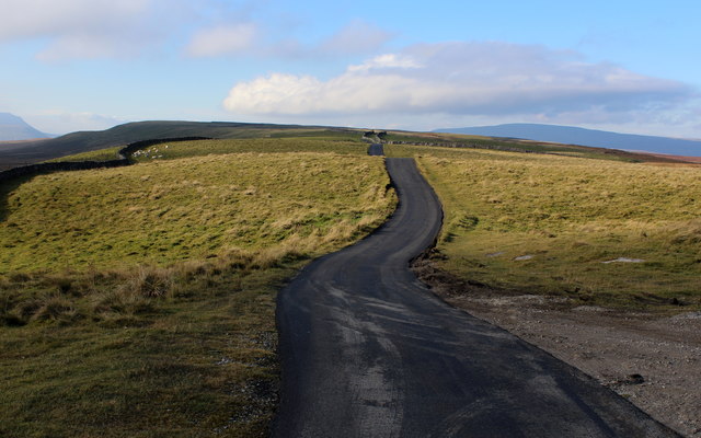
The surface of Cam High Road was still warm on this particular visit. A conveyor belt of machinery was slowly stripping the old surface and replacing it with a thick layer of tarmac.
This has altered the landscape hereabouts - I rather liked the previous rutted effort with central grass strip. The lane terminates at the isolated settlement of Cam Houses - this will improve travel time for them.
This also carries the Pennine Way National Trail.
This has altered the landscape hereabouts - I rather liked the previous rutted effort with central grass strip. The lane terminates at the isolated settlement of Cam Houses - this will improve travel time for them.
This also carries the Pennine Way National Trail.
The Pennine Way
The Pennine Way is a National Trail in England, with a small section in Scotland. The trail runs 267 miles from Edale, in the northern Derbyshire Peak District, north through the Yorkshire Dales and the Northumberland National Park and ends at Kirk Yetholm, just inside the Scottish border. The path runs along the Pennine hills, sometimes described as the "backbone of England". Although not the United Kingdom's longest National Trail, it is according to the Ramblers' Association "one of Britain's best known and toughest".
 Map © Crown Copyright")
TIP: Click the map for more Large scale mapping
- Grid Square
- SD8283, 19 images (more nearby 🔍)
- Photographer
- Chris Heaton (more nearby)
- Date Taken
- Monday, 26 October, 2015 (more nearby)
- Submitted
- Monday, 2 November, 2015
- Subject Location
-
OSGB36:
 SD 8291 8335 [10m precision]
WGS84: 54:14.7330N 2:15.8254W - Camera Location
-
OSGB36: SD 8296 8337
- View Direction
- West-southwest (about 247 degrees)