2015
TQ1690 : The trackbed of the former Harrow & Stanmore Railway
taken 8 years ago, near to Stanmore, Harrow, England
This is 1 of 2 images, with title The trackbed of the former Harrow & Stanmore Railway in this square
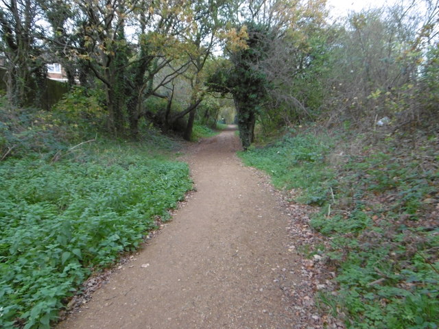
The trackbed of the former Harrow & Stanmore Railway
In the 1880s the village of Great Stanmore attracted the attention of the London hotel and restaurant magnate Frederick Gordon. In 1882 he bought the Bentley Priory estate with the intention of converting it into a country resort for his London hotel guests. He realised the project would not prosper without some improvement in railway communication.
The Harrow & Stanmore Railway was authorised in 1886 from a junction with the up slow line at Harrow. The first train left Harrow for Stanmore on 18th December 1890. However, there was no sign by the early 20th century of any traffic potential. Gordon's enterprise at Stanmore failed and the line's business was very light. A few houses appeared near the station but the Bentley Priory hotel failed and Gordon moved in with his wife and 11 children. Gordon died in 1904. The country between Harrow and Stanmore remained almost entirely open until well into the 1920s.
In response to house builders, a wooden halt was opened on 12th September 1932 called Belmont where the branch passed under Kenton Lane. With the building of low cost housing in the area Belmont became and remained the main traffic generator for the branch. The station was rebuilt by 1937.
Sunday trains were permanently withdrawn from 27th July 1947. After 13th September 1952 the station at Stanmore saw only a daily freight train and these continued until August 1964 - track lifting started soon afterwards. Ordinary bookings from Belmont faded away almost completely from the early 1960s. Closure of the line from Belmont to Harrow & Wealdstone was included in the Beeching report and the last passenger train ran on 3rd October 1964. Belmont station was demolished in July 1966. The trackbed between Christchurch Avenue and Vernon Drive has now been made into a path called the Belmont Trail. For more information see Link
This is looking towards Vernon Drive.
 Map © Crown Copyright")
TIP: Click the map for more Large scale mapping
- Grid Square
- TQ1690, 90 images (more nearby 🔍)
- Photographer
- Marathon (more nearby)
- Date Taken
- Wednesday, 11 November, 2015 (more nearby)
- Submitted
- Thursday, 12 November, 2015
- Subject Location
-
OSGB36:
 TQ 1669 9083 [10m precision]
WGS84: 51:36.2537N 0:18.9864W - Camera Location
-
OSGB36: TQ 1665 9076
- View Direction
- Northeast (about 45 degrees)