2015
TQ3077 : St Marks CE School
taken 8 years ago, near to Lambeth, England
St Marks CE School
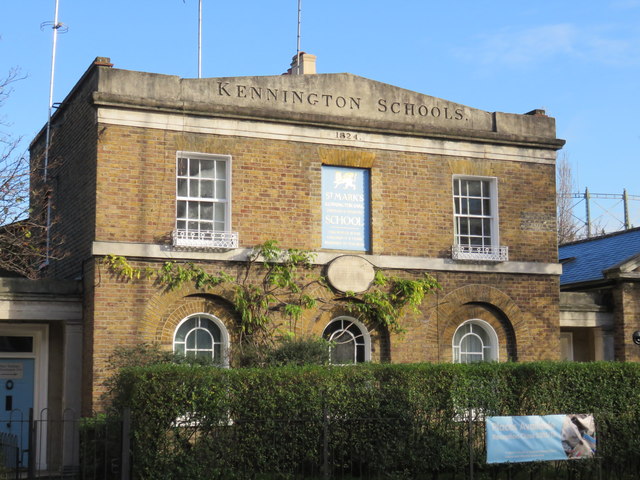
The 1820s saw the foundation of two schools at the Oval, Kennington. After raising the necessary voluntary subscriptions, the boys' school opened at the end of 1824 and the girls' school in the spring of 1825. The name proposed for the schools was the Kennington and South Lambeth National School, but they were soon referred to as the National Schools or District Schools, even the Oval Schools. In reflection of the close links with St Mark's Church, the name was later changed to St Mark Kennington Schools. The school is now known as St Mark's CE Primary School.Link
 Map © Crown Copyright")
TIP: Click the map for more Large scale mapping
- Grid Square
- TQ3077, 490 images (more nearby 🔍)
- Photographer
- Richard Rogerson (more nearby)
- Date Taken
- Sunday, 22 November, 2015 (more nearby)
- Submitted
- Sunday, 22 November, 2015
- Subject Location
-
OSGB36:
 TQ 3082 7784 [10m precision]
WGS84: 51:29.0634N 0:7.0408W - Camera Location
-
OSGB36: TQ 3081 7782
- View Direction
- North-northeast (about 22 degrees)