2015
J3826 : Bifurcated channel and river cliff on the lower section of the Bloody Bridge River
taken 9 years ago, 6 km S of Newcastle, Co Down, Northern Ireland
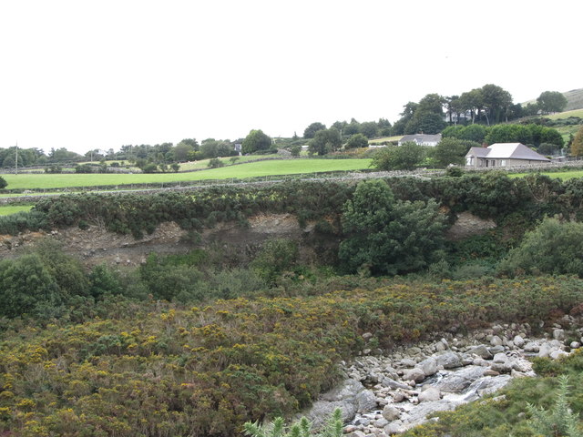
Bifurcated channel and river cliff on the lower section of the Bloody Bridge River
The Bloody Bridge River has incised itself into the surface of the narrow coastal plain. The coastal plain is composed of a great thickness of glacial debris and this is exposed in the river cliff. Eroded debris has formed islands on the river bed which causes the river to split up into channels.
Loading map... (JavaScript required)
- Grid Square
- J3826, 116 images (more nearby 🔍)
- Photographer
- Eric Jones (more nearby)
- Date Taken
- Monday, 7 September, 2015 (more nearby)
- Submitted
- Sunday, 22 November, 2015
- Subject Location
-
Irish:
 J 384 269 [100m precision]
WGS84: 54:10.3525N 5:52.8631W - Camera Location
-
Irish: J 384 269
- View Direction
- Southwest (about 225 degrees)