1994
NY5002 : NW up Long Sleddale
taken 30 years ago, 4 km NW of Garnett Bridge, Cumbria, England
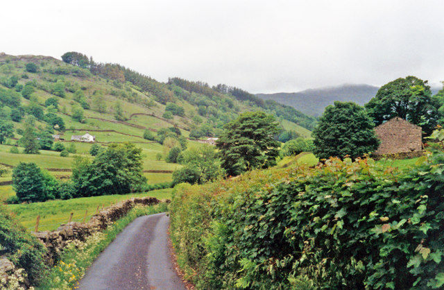
NW up Long Sleddale
The view is near Yewbarrow Hall, with Harter Fell (2,509 ft.) ahead. This road goes no further than the head of the valley, but in the 1840s it nearly became the route of the Lancaster & Carlisle Railway - part of the present West Coast Main Line; instead, it is followed by the pipeline to Manchester from Haweswater Reservoir.
 Map © Crown Copyright")
TIP: Click the map for more Large scale mapping
- Grid Square
- NY5002, 27 images (more nearby 🔍)
- Photographer
- Ben Brooksbank (more nearby)
- Date Taken
- Sunday, 19 June, 1994 (more nearby)
- Submitted
- Saturday, 28 November, 2015
- Subject Location
-
OSGB36:
 NY 503 024 [100m precision]
WGS84: 54:24.8819N 2:46.0028W - Camera Location
-
OSGB36: NY 503 024
- View Direction
- Northwest (about 315 degrees)