2015
SO7038 : Ordnance Survey flush bracket no.411
taken 8 years ago, near to Ledbury, County of Herefordshire, England
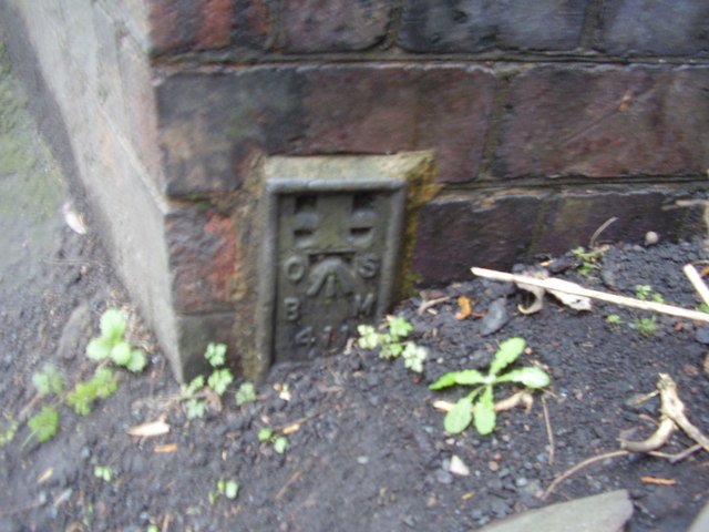
Ordnance Survey flush bracket no.411
This flush bracket was established in 1913 during the Second geodetic levelling of England & Wales, and was levelled with a height of 245.5540 feet [74.8449 metres] above mean sea level (Newlyn datum). It was included on the Brampton Abbotts to Suckley levelling line. The surveyor's description was "Flush Bracket on N. end of railway bridge, Ledbury Railway Station." The bracket is on the west side of the road, next to a lamppost.
 Map © Crown Copyright")
TIP: Click the map for more Large scale mapping
- Grid Square
- SO7038, 170 images (more nearby 🔍)
- Photographer
- Shantavira (more nearby)
- Date Taken
- Thursday, 3 December, 2015 (more nearby)
- Submitted
- Friday, 4 December, 2015
- Subject Location
-
OSGB36:
 SO 7084 3864 [10m precision]
WGS84: 52:2.7228N 2:25.5954W - Camera Location
-
OSGB36: SO 7084 3864
- View Direction
- South-southwest (about 202 degrees)