2015
SO6692 : Ordnance Survey Cut Mark
taken 8 years ago, near to Upton Cressett, Shropshire, England
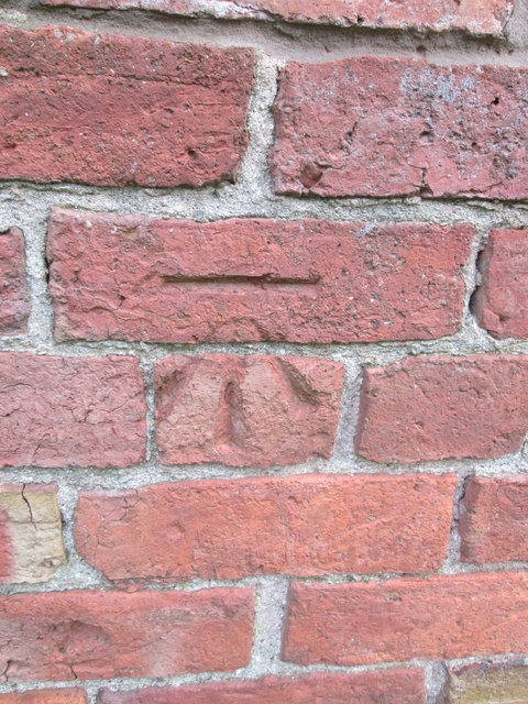
Ordnance Survey Cut Mark
This OS cut mark can be found on the farm building at Meadowley. It marks a point 203.617m above mean sea level.
 Map © Crown Copyright")
TIP: Click the map for more Large scale mapping
- Grid Square
- SO6692, 11 images (more nearby 🔍)
- Photographer
- Adrian Dust (more nearby)
- Date Taken
- Thursday, 26 November, 2015 (more nearby)
- Submitted
- Thursday, 10 December, 2015
- Subject Location
-
OSGB36:
 SO 6677 9251 [10m precision]
WGS84: 52:31.7663N 2:29.4758W - Camera Location
-
OSGB36: SO 6677 9251
- View Direction
- East-northeast (about 67 degrees)