TQ7410 : Combe Valley Way
taken 8 years ago, near to Sidley, East Sussex, England
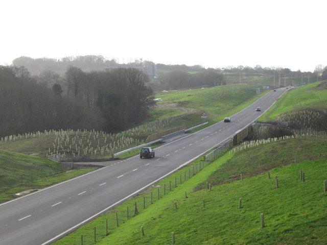
The Combe Valley Way Hastings to Bexhill link road connects the Queenway to the West of St Leonards and the A259 and Wrestwood Road in Bexhill.
Construction of the road began in 2013 and opened 17th December 2015 with the surrounding paths finished in 2016, at a cost of over £120m.
As with most new roads, the project has had its objectors. The road runs closely past four working farms, two sites of special scientific interest (SSSI), and a site of nature conservation importance (SNCI). A group of protesters attempted to slow the clearing of trees in January 2013.
As well as the road, a bridleway, cycle paths and pedestrian footpaths, and numerous ponds and drainage ponds were created alongside to form an enhanced and more accessible Combe Valley Countryside Park.
Although a public vote chose to name the road 'Robert Wood Way', after a local soldier, the name 'Combe Valley Way', was chosen by Rother District Council councillors. Chosen to highlight the presence of the park and be clearer for emergency services.
Also see the Geograph article Link
and
Combe Valley Way construction Link
 Map © Crown Copyright")
- Grid Square
- TQ7410, 117 images (more nearby 🔍)
- Photographer
- Oast House Archive (more nearby)
- Date Taken
- Saturday, 19 December, 2015 (more nearby)
- Submitted
- Saturday, 19 December, 2015
- Subject Location
-
OSGB36:
 TQ 748 100 [100m precision]
WGS84: 50:51.8006N 0:28.9861E - Camera Location
-
OSGB36: TQ 748 102
- View Direction
- SOUTH (about 180 degrees)