2015
SE7098 : Rosedale East - calcining kilns
taken 8 years ago, near to Thorgill, North Yorkshire, England
This is 1 of 3 images, with title Rosedale East - calcining kilns in this square
Rosedale East - calcining kilns
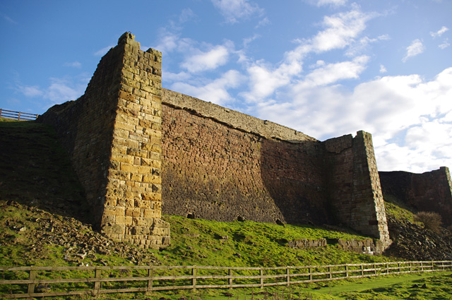
Iron ore was mined on the east side of Rosedale between 1860 and 1926.
These `iron' kilns were used to calcine (roast) the ironstone to reduce the weight of material which had to be transported. The best-preserved northern section of this group of 3 kilns is shown in this photo.
(Compare with the more conventional stone kilns to the south - SE7098 : Rosedale East - calcining kilns.)
 Map © Crown Copyright")
TIP: Click the map for more Large scale mapping
- Grid Square
- SE7098, 71 images (more nearby 🔍)
- Photographer
- Ian Taylor (more nearby)
- Date Taken
- Tuesday, 8 December, 2015 (more nearby)
- Submitted
- Saturday, 2 January, 2016
- Subject Location
-
OSGB36:
 SE 7053 9884 [10m precision]
WGS84: 54:22.8110N 0:54.9371W - Camera Location
-
OSGB36: SE 7053 9885
- View Direction
- Southeast (about 135 degrees)