Geograph - photograph every grid square
1995
SZ3084
: West High Down
taken
29 years ago
, 3 km from
Totland
, Isle of Wight, England
This is 1 of
5 images, with title West High Down
in this square
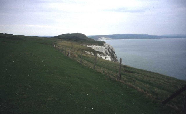
West High Down
Looking eastwards from the clifftop path towards Tennyson Down.
© Copyright
Trevor Rickard
and licensed for
reuse
under this
Creative Commons Licence
.
Licensing
Download
Share...
Share this photo via Twitter
Share this photo via Facebook
Share this photo via Pinterest
Share this photo via Flipboard
Share this photo via email/e-card
Grab a Stamped/Watermarked Image
Mark
👍🏻
Like Image
👍🏻
Like Description
Update Information
Contact Contributor
Category:
Downland
This photo is linked from:
Automatic Clusters
: ·
Clifftop [3]
Title Clusters
: ·
West High Down [5]
·
TIP: Click the map for more Large scale mapping
Grid Square
SZ3084
, 80 images (
more nearby
🔍
)
Photographer
Trevor Rickard
(
more nearby
)
Date Taken
October 1995 (
more nearby
)
Submitted
Wednesday, 27 June, 2007
Subject Location
OSGB36:
SZ 309 849
[100m precision]
WGS84:
50:39.7826N
1:33.7824W
Camera Location
OSGB36:
SZ 307 848
View Direction
EAST (about 90 degrees)
NW
N
NE
W
Go
E
SW
S
SE
Discuss SZ3084
View this location on ...
Geograph Coverage Map (includes OSM etc)
Geograph Links Page
Open in Google Maps
Navigate to location with Google Maps
Open in Google Earth Pro
Open in Google Earth for Web
Open in Bing Maps
Navigate with Google Maps
Lookup nearest Postcode
Image classification
(about)
: Geograph (Third Visitor for SZ3084) · First in 5 Years (TPoint)
(about)
This page has been
viewed
about
52
times
☰
Home
View
Search
Marked Images
Maps
Browser
Explore
Showcase
New Images
Collections
Interact
Games
Discussions
Blog
Contributors
Submit
Statistics
Leaderboards
General
FAQ
Help Pages
Sitemap
Contact Us
Support Us
sponsored by
🔍
What to search:
Photos
Enter keywords or a location/postcode to search nearby images
Photos near SZ3084
Enter a Grid Reference
Placenames
Collections
Website Pages
Everything
Others:
Advanced Search
|
Image Browser
Or:
Coverage Map
|
Searchable Map
You are not logged in
login
|
register