2016
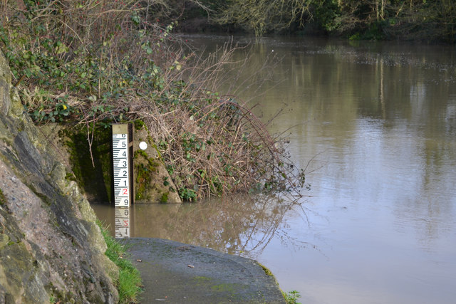
SP2965 : Level gauge by the River Avon, southeast Warwick 2016-01-08
taken 8 years ago, near to Warwick, Warwickshire, England
This is 1 of 2 images, with title starting with Level gauge by the River Avon, southeast Warwick in this square
Level gauge by the River Avon, southeast Warwick 2016-01-08
The gauge reads 1.9 metres, high enough to completely submerge the fishing peg 400 metres downstream, and half-fill the nearby ditch: SP2965 : The river has filled a ditch and submerged a fishing peg, Myton, southeast Warwick.
See other images of Calibrating the Avon
 Map © Crown Copyright")
TIP: Click the map for more Large scale mapping
- Grid Square
- SP2965, 1818 images (more nearby 🔍)
- Photographer
- Robin Stott (more nearby)
- Date Taken
- Friday, 8 January, 2016 (more nearby)
- Submitted
- Friday, 15 January, 2016
- Subject Location
-
OSGB36:
 SP 2992 6530 [10m precision]
WGS84: 52:17.1018N 1:33.7687W - Camera Location
-
OSGB36: SP 2991 6529
- View Direction
- Northeast (about 45 degrees)