2005
TQ2106 : Mill Hill, Shoreham
taken 19 years ago, near to Kingston by Sea, West Sussex, England
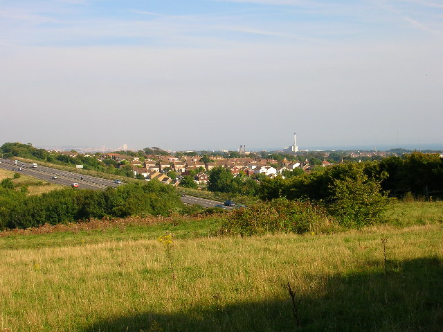
Mill Hill, Shoreham
Taken from the road just beyond the bridge over the main A27 trunk road, the view looks south west through the Mill Hill estate and follows the square to its edge roughly before the first small set of chimneys at Southland Hospital. To the right is the even bigger chimney of Shoreham power station and beyond that is the sea. On the left hand side is a faint view of Brighton, 6 miles away. The large block of flats just visible is Sussex Heights.
 Map © Crown Copyright")
TIP: Click the map for more Large scale mapping
- Grid Square
- TQ2106, 42 images (more nearby 🔍)
- Photographer
- Simon Carey (more nearby)
- Date Taken
- Friday, 2 September, 2005 (more nearby)
- Submitted
- Friday, 2 September, 2005
- Subject Location
-
OSGB36:
 TQ 215 065 [100m precision]
WGS84: 50:50.7165N 0:16.5349W