2016
SK1134 : The old road to Uttoxeter
taken 8 years ago, near to Doveridge, Derbyshire, England
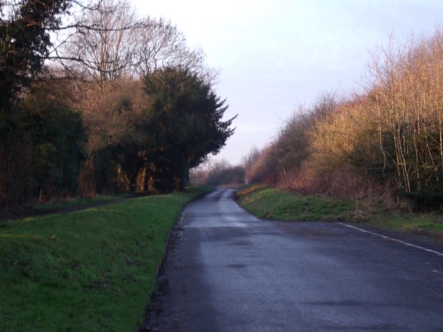
The old road to Uttoxeter
This used to be part of the dual carriageway that lead down the hill to Uttoxeter. When Doveridge was bypassed in the late 90s, the old route was closed. This section was retained for local access only.
 Map © Crown Copyright")
TIP: Click the map for more Large scale mapping
- Grid Square
- SK1134, 53 images (more nearby 🔍)
- Photographer
- Ian Calderwood (more nearby)
- Date Taken
- Tuesday, 19 January, 2016 (more nearby)
- Submitted
- Tuesday, 19 January, 2016
- Subject Location
-
OSGB36:
 SK 1147 3455 [10m precision]
WGS84: 52:54.4957N 1:49.8539W - Camera Location
-
OSGB36: SK 1151 3452
- View Direction
- Northwest (about 315 degrees)