2016
SN6136 : Heol ar gau / Road closed
taken 8 years ago, near to Llansawel, Carmarthenshire/Sir Gaerfyrddin, Wales
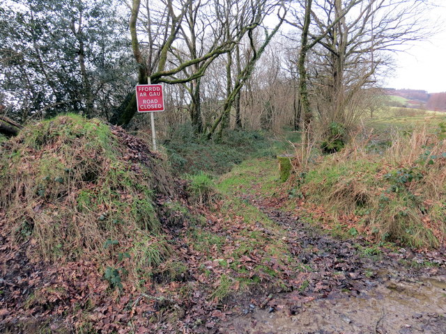
Heol ar gau / Road closed.
Hen heol sy bellach ar gau i foduron.
An old road now closed to vehicles.
An old road now closed to vehicles.
 Map © Crown Copyright")
TIP: Click the map for more Large scale mapping
- Grid Square
- SN6136, 25 images (more nearby 🔍)
- Photographer
- Alan Richards (more nearby)
- Date Taken
- Tuesday, 19 January, 2016 (more nearby)
- Submitted
- Tuesday, 19 January, 2016
- Subject Location
-
OSGB36:
 SN 6112 3655 [10m precision]
WGS84: 52:0.5973N 4:1.4941W - Camera Location
-
OSGB36: SN 6116 3653
- View Direction
- West-northwest (about 292 degrees)