2016
SX2164 : Dobwalls Football Club
taken 8 years ago, near to Dobwalls, Cornwall, England
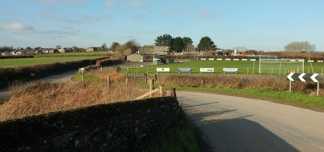
Dobwalls Football Club
The ground is on the south side of the village by the road to Duloe, seen here from the railway bridge from which SX2164 : Main line near Dobwalls was taken.
 Map © Crown Copyright")
TIP: Click the map for more Large scale mapping
- Grid Square
- SX2164, 23 images (more nearby 🔍)
- Photographer
- Derek Harper (more nearby)
- Date Taken
- Wednesday, 20 January, 2016 (more nearby)
- Submitted
- Saturday, 23 January, 2016
- Subject Location
-
OSGB36:
 SX 2191 6457 [10m precision]
WGS84: 50:27.2319N 4:30.6055W - Camera Location
-
OSGB36: SX 2196 6448
- View Direction
- North-northwest (about 337 degrees)