2015
NN5529 : Descent to Killin
taken 9 years ago, 4 km E of Ardchyle, Stirling, Scotland
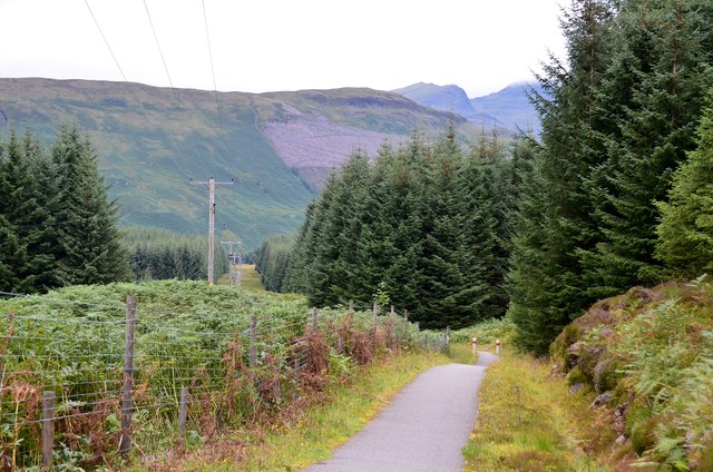
Descent to Killin
On the Rob Roy Way and cyclepath heading down to Glen Dochart with the peaks of the Tarmachan group on the right-hand skyline.
 Map © Crown Copyright")
TIP: Click the map for more Large scale mapping
- Grid Square
- NN5529, 13 images (more nearby 🔍)
- Photographer
- Jim Barton (more nearby)
- Date Taken
- Friday, 4 September, 2015 (more nearby)
- Submitted
- Saturday, 23 January, 2016
- Subject Location
-
OSGB36:
 NN 5577 2919 [10m precision]
WGS84: 56:25.9674N 4:20.4334W - Camera Location
-
OSGB36: NN 5576 2915
- View Direction
- NORTH (about 0 degrees)