2016
NY8855 : The valley of the Linn Burn
taken 8 years ago, 5 km SW of Dalton, Northumberland, England
This is 1 of 2 images, with title The valley of the Linn Burn in this square
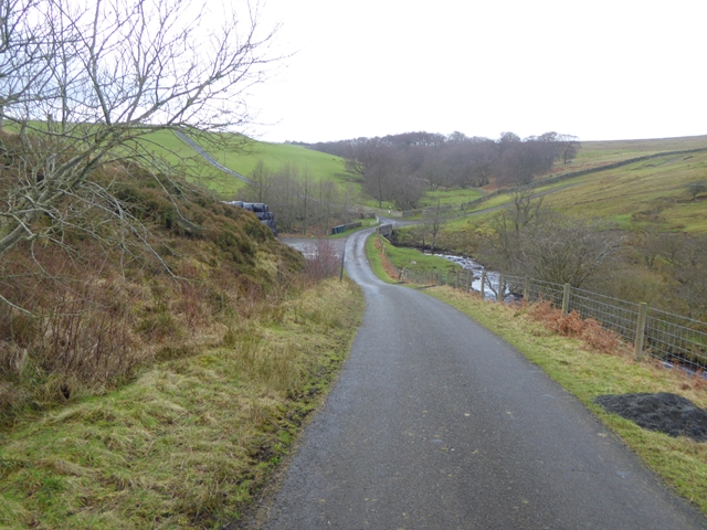
The valley of the Linn Burn
The public road ends at the bridge. A farm road can be seen on the hillside to the left serving Westburnhope. To the right a public bridleway climbs up on to Burntridge Moor.
 Map © Crown Copyright")
TIP: Click the map for more Large scale mapping
- Grid Square
- NY8855, 60 images (more nearby 🔍)
- Photographer
- Oliver Dixon (more nearby)
- Date Taken
- Saturday, 23 January, 2016 (more nearby)
- Submitted
- Saturday, 23 January, 2016
- Subject Location
-
OSGB36:
 NY 8868 5511 [10m precision]
WGS84: 54:53.4360N 2:10.6803W - Camera Location
-
OSGB36: NY 88807 55181
- View Direction
- West-southwest (about 247 degrees)