2016
SK5731 : Road beside Rushcliffe Country Park
taken 8 years ago, near to Bradmore, Nottinghamshire, England
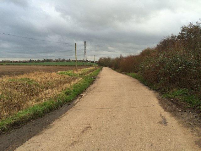
Road beside Rushcliffe Country Park
This road starts at the A60 between the entrance to the Country Park and Bradmore and leads to a couple of farms. It is a gated private road but at the next bend a public footpath branches off and heads for Bradmore. Some properties in the village can be seen mixed-in with the trees on the skyline.
 Map © Crown Copyright")
TIP: Click the map for more Large scale mapping
- Grid Square
- SK5731, 26 images (more nearby 🔍)
- Photographer
- David Lally (more nearby)
- Date Taken
- Monday, 25 January, 2016 (more nearby)
- Submitted
- Monday, 25 January, 2016
- Subject Location
-
OSGB36:
 SK 5793 3175 [10m precision]
WGS84: 52:52.8062N 1:8.4383W - Camera Location
-
OSGB36: SK 57915 31800
- View Direction
- South-southeast (about 157 degrees)