2007
TF7845 : Brancaster Harbour
taken 17 years ago, near to Brancaster Staithe, Norfolk, England
This is 1 of 2 images, with title Brancaster Harbour in this square
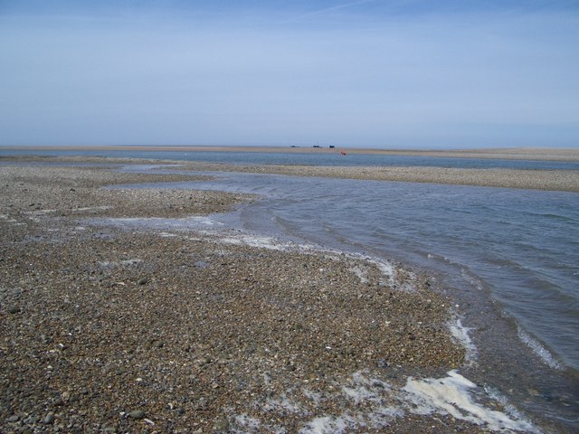
Brancaster Harbour
This view looks out across Brancaster Harbour, more a river channel, with a single red buoy visible on its northern edge. Beyond that, and in the next grid square, is the wreck of the SS Vina built in 1894 at Grangemouth. The Vina acted as a block ship for Yarmouth Harbour in 1940 and was towed to Brancaster in 1943 where she was used by the RAF as a target for testing a new shell. In 1944 a NW gale put her on to her present location where she sank and in later years was part salvaged.
 Map © Crown Copyright")
TIP: Click the map for more Large scale mapping
- Grid Square
- TF7845, 19 images (more nearby 🔍)
- Photographer
- Nigel Stickells (more nearby)
- Date Taken
- Tuesday, 19 June, 2007 (more nearby)
- Submitted
- Friday, 29 June, 2007
- Subject Location
-
OSGB36:
 TF 7840 4580 [10m precision]
WGS84: 52:58.7909N 0:39.3483E - Camera Location
-
OSGB36: TF 7855 4558
- View Direction
- North-northwest (about 337 degrees)