NJ7324 : Balquhain Recumbent Stone Circle (17)
taken 8 years ago, near to Inveramsay, Aberdeenshire, Scotland
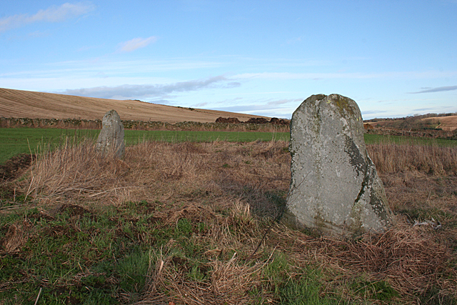
Recumbent stone circles are unique to the farmlands of north-eastern Scotland. They are so called because in a south-western or south-eastern sector of the circle they include a long low stone wedged in position so that its upper surface is horizontal. This stone is termed a recumbent.
The recumbent is flanked by the two tallest stones of the circle, and inside it there are usually two lower stones laid at right angles to the ends of the recumbent.
The rest of the stones in the circle, technically referred to as orthostats, are usually graded in height, the tallest being closest to the recumbent, and each one lower than its neighbour until the lowest stone, diametrically opposite the recumbent.
For a more detailed, and organised, article see Link
 Map © Crown Copyright")
- Grid Square
- NJ7324, 35 images (more nearby 🔍)
- Photographer
- Anne Burgess (more nearby)
- Date Taken
- Thursday, 28 January, 2016 (more nearby)
- Submitted
- Thursday, 28 January, 2016
- Subject Location
-
OSGB36:
 NJ 7349 2408 [10m precision]
WGS84: 57:18.3916N 2:26.4990W - Camera Location
-
OSGB36: NJ 7348 2407
- View Direction
- Northeast (about 45 degrees)