2016
NN1856 : Whisky Galore
taken 8 years ago, 4 km W of Altnafeadh, Highland, Scotland
Whisky Galore
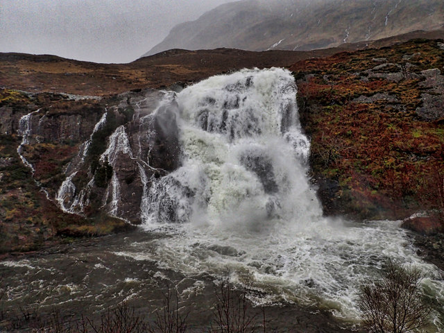
About half way down Glencoe there is a parking spot which is usually heavy with coaches and tourists stopping to take a photo of this waterfall on the River Coe. Today with ex-Hurricane Jonas dumping everything he had left on Scotland the layby was empty but the waterfall was spectacular.
The waterfall is often referred to as the Meeting of the Three Waters but the Ordnance Survey have given that name to the symmetrical confluence of the streams Allt Doire-bheith and Allt Coire Gabhail with the River Coe, a kilometre down the glen (see NN1756 : Meeting of the Three Waters). I feel this waterfall ought to have a name but it eludes me at the moment.
So to the title, Whisky Galore. A little contrived. Both whisky and galore are words that have entered English from the Gaelic. Uisge means water and uisge baugh water of life and anglicised to whisky. From gu leor meaning plenty we get the word galore we use in English. So with apologises to Compton Mackenzies book theres plenty of water going over the waterfall.
From my daily photo blog Link
 Map © Crown Copyright")
TIP: Click the map for more Large scale mapping
- Grid Square
- NN1856, 106 images (more nearby 🔍)
- Photographer
- Mick Garratt (more nearby)
- Date Taken
- Tuesday, 26 January, 2016 (more nearby)
- Submitted
- Saturday, 30 January, 2016
- Subject Location
-
OSGB36:
 NN 1833 5619 [10m precision]
WGS84: 56:39.7262N 4:57.9478W - Camera Location
-
OSGB36: NN 1827 5623
- View Direction
- Southeast (about 135 degrees)