2016
SE0221 : Junction of the north branch of Ripponden FP1 with the main path
taken 8 years ago, near to Cotton Stones, Calderdale, England
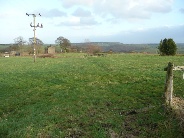
Junction of the north branch of Ripponden FP1 with the main path
This view is along the main FP1, which is faintly visible in the grass. When it reaches the little tree, in the centre of the image, it crosses the remains of Cow Lane and continues to the driveway to Lower Burnt Moor Farm. The path past Upper Burnt Moor Farm goes through a foot-gate to the right (I did not notice it until later). The branch path from Kennel Lane, Sowerby, joins invisibly from the left.
 Map © Crown Copyright")
TIP: Click the map for more Large scale mapping
- Grid Square
- SE0221, 118 images (more nearby 🔍)
- Photographer
- Humphrey Bolton (more nearby)
- Date Taken
- Monday, 1 February, 2016 (more nearby)
- Submitted
- Monday, 1 February, 2016
- Subject Location
-
OSGB36:
 SE 0233 2166 [10m precision]
WGS84: 53:41.4830N 1:57.9716W - Camera Location
-
OSGB36: SE 0233 2166
- View Direction
- EAST (about 90 degrees)