2014
NZ1859 : Front elevation of Old Hollinside
taken 10 years ago, 3 km from Rowlands Gill, Gateshead, England
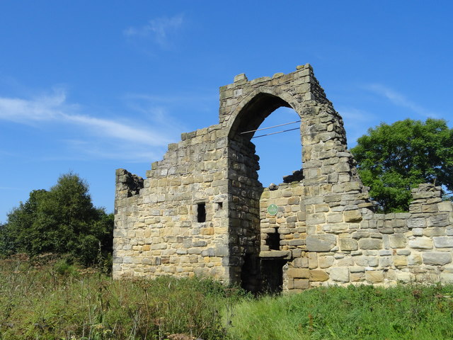
Front elevation of Old Hollinside
This is a fortified manor house which stands on a bluff a short distance south of the River Derwent. It probably dates to the C13 and is first mentioned in a will of 1317. It eventually passed to the Bowes family of nearby Gibside.
 Map © Crown Copyright")
TIP: Click the map for more Large scale mapping
- Grid Square
- NZ1859, 50 images (more nearby 🔍)
- Photographer
- Robert Graham (more nearby)
- Date Taken
- Friday, 25 July, 2014 (more nearby)
- Submitted
- Saturday, 6 February, 2016
- Subject Location
-
OSGB36:
 NZ 1854 5991 [10m precision]
WGS84: 54:56.0115N 1:42.7312W - Camera Location
-
OSGB36: NZ 1857 5990
- View Direction
- West-northwest (about 292 degrees)