2016
SO1139 : Upper Llangoed
taken 8 years ago, near to Boughrood, Powys, Wales
Upper Llangoed
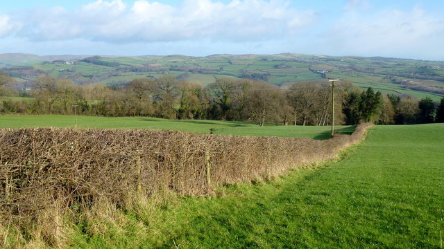
The top of Llangoed Wood viewed from the road over Brechfa Common.
In the distance, over the Wye valley, we can see the Begwns and the associated hills of South Radnorshire.
In the distance, over the Wye valley, we can see the Begwns and the associated hills of South Radnorshire.
 Map © Crown Copyright")
TIP: Click the map for more Large scale mapping
- Grid Square
- SO1139, 9 images (more nearby 🔍)
- Photographer
- Jonathan Billinger (more nearby)
- Date Taken
- Tuesday, 2 February, 2016 (more nearby)
- Submitted
- Sunday, 7 February, 2016
- Subject Location
-
OSGB36:
 SO 1145 3923 [10m precision]
WGS84: 52:2.6620N 3:17.5526W - Camera Location
-
OSGB36: SO 1141 3919
- View Direction
- Northeast (about 45 degrees)