2016
SK4580 : The course of the Chesterfield Canal
taken 8 years ago, near to Killamarsh, Derbyshire, England
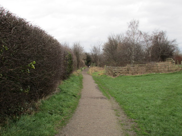
The course of the Chesterfield Canal
From Walford Road to the fence in the centre of this picture the canal has been infilled and only the towpath remains. Beyond the fence the canal is visible for a couple of hundred metres before a more lengthy stretch of infilling.
 Map © Crown Copyright")
TIP: Click the map for more Large scale mapping
- Grid Square
- SK4580, 174 images (more nearby 🔍)
- Photographer
- Jonathan Thacker (more nearby)
- Date Taken
- Friday, 5 February, 2016 (more nearby)
- Submitted
- Sunday, 7 February, 2016
- Subject Location
-
OSGB36:
 SK 4549 8083 [10m precision]
WGS84: 53:19.3468N 1:19.1124W - Camera Location
-
OSGB36: SK 4546 8082
- View Direction
- East-northeast (about 67 degrees)