2016
TM1779 : Concreted road linking Sites 3 and 4
taken 8 years ago, near to Upper Street, Norfolk, England
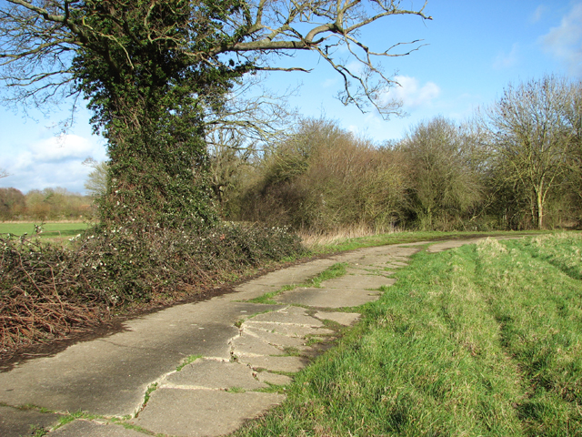
Concreted road linking Sites 3 and 4
This road was built during WW2 when RAF Thorpe Abbotts was an active airfield. It linked two of the aerodrome's domestic sites. The concrete surface has buckled and cracked, probably caused by the underlying roots of the old trees growing alongside it.
See also: Link
See also: Link
 Map © Crown Copyright")
TIP: Click the map for more Large scale mapping
- Grid Square
- TM1779, 105 images (more nearby 🔍)
- Photographer
- Evelyn Simak (more nearby)
- Date Taken
- Sunday, 7 February, 2016 (more nearby)
- Submitted
- Monday, 8 February, 2016
- Subject Location
-
OSGB36:
 TM 1783 7954 [10m precision]
WGS84: 52:22.2346N 1:11.9050E - Camera Location
-
OSGB36: TM 1781 7952
- View Direction
- Northeast (about 45 degrees)