2015
SX4853 : Breakwater, Mountbatten Point
taken 8 years ago, near to Turnchapel, Plymouth, England
This is 1 of 2 images, with title Breakwater, Mountbatten Point in this square
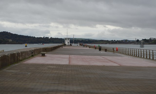
Breakwater, Mountbatten Point
Work on the Mount Batten Breakwater. (also referred to as Mount Batten Pier and Cattewater Breakwater) started in 1878 and was completed in 1881 at a total cost of £20,000. It is 915 feet in length and the foundations are 20 feet below the low tide mark. The breakwater was promoted by the Cattewater Commissioners who were responsible for shipping in the area. During the air-station years the breakwater was closed to the public and used, for a period, to store flying boats. In 1995 the breakwater was refurbished and re-opened to the public.
See other images of Mount Batten Breakwater
See other images of Mount Batten Breakwater
 Map © Crown Copyright")
TIP: Click the map for more Large scale mapping
- Grid Square
- SX4853, 1004 images (more nearby 🔍)
- Photographer
- N Chadwick (more nearby)
- Date Taken
- Saturday, 24 October, 2015 (more nearby)
- Submitted
- Thursday, 11 February, 2016
- Subject Location
-
OSGB36:
 SX 4837 5324 [10m precision]
WGS84: 50:21.5691N 4:7.9844W - Camera Location
-
OSGB36: SX 4847 5324
- View Direction
- WEST (about 270 degrees)