2007
SK8085 : West Burton deserted village, looking onto Burton Round
taken 17 years ago, near to Sturton le Steeple, Nottinghamshire, England
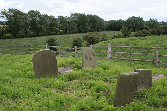
West Burton deserted village, looking onto Burton Round
Gravestones in the former churchyard overlook the old bed of the River Trent. The line of willows mark the near bank. The loop was cut off at the end of the 18th Century but the resulting ox-bow lake has been completely filled in. The course can be clearly followed on the map. The name Burton Round is shown following the course of the river on the 1:25000 map, with the enclosed area being named The Ferries. The inference is that the area was farmed from the village with access by ferries. The 'Round' could well derive from navigators of the river who would have had to make virtually a complete circle before the river made the cut; they were probably very happy at the change!
 Map © Crown Copyright")
TIP: Click the map for more Large scale mapping
- Grid Square
- SK8085, 16 images (more nearby 🔍)
- Photographer
- Alan Murray-Rust (more nearby)
- Date Taken
- Sunday, 1 July, 2007 (more nearby)
- Submitted
- Monday, 2 July, 2007
- Subject Location
-
OSGB36:
 SK 800 851 [100m precision]
WGS84: 53:21.4304N 0:47.8867W - Camera Location
-
OSGB36: SK 800 852
- View Direction
- Southeast (about 135 degrees)