2007
NZ5319 : Trunk Road
taken 17 years ago, near to South Bank, Redcar And Cleveland, England
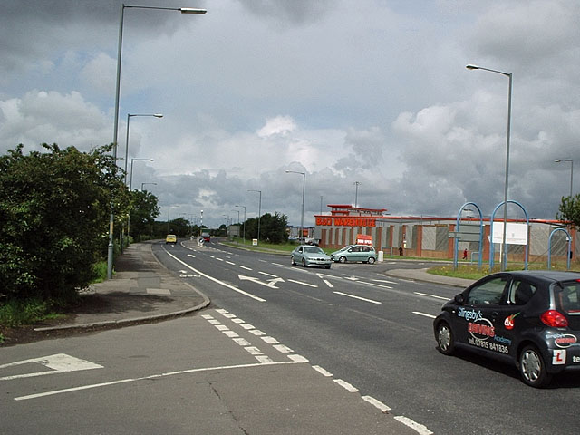
Trunk Road
Trunk Road looking west from where Skippers Lane crosses it.
B&Q on Cleveland Retail Park is on the other side.
B&Q on Cleveland Retail Park is on the other side.
 Map © Crown Copyright")
TIP: Click the map for more Large scale mapping
- Grid Square
- NZ5319, 16 images (more nearby 🔍)
- Photographer
- Stephen McCulloch (more nearby)
- Date Taken
- Tuesday, 3 July, 2007 (more nearby)
- Submitted
- Tuesday, 3 July, 2007
- Subject Location
-
OSGB36:
 NZ 533 196 [100m precision]
WGS84: 54:34.1455N 1:10.6271W - Camera Location
-
OSGB36: NZ 533 195
- View Direction
- West-northwest (about 292 degrees)