2016
SS8380 : Public footpath off Heol-y-Sheet, nr North Cornelly
taken 8 years ago, near to South Cornelly, Bridgend/Pen-y-Bont ar Ogwr, Wales
Public footpath off Heol-y-Sheet, nr North Cornelly
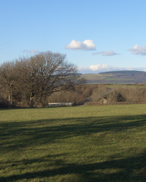
A picture taken at the southern end of a public footpath on the lane Heol-y-Sheet. The path is indistinct on the ground, but Ordnance Survey mapping shows it running directly to a field boundary location more or less where the prominent tree seen in the left of the image is situated. From there, the path passes through the gap in a fence seen beyond and across a bridge over the M4 motorway. The bridge, which can be made out just beyond the gap in the fence, is seen closer up in SS8380 : Bridge over the M4 east of North Cornelly.
When the photograph was taken, towards the end of a wet winter, the path was very squelchy in places .
When the photograph was taken, towards the end of a wet winter, the path was very squelchy in places .
 Map © Crown Copyright")
TIP: Click the map for more Large scale mapping
- Grid Square
- SS8380, 57 images (more nearby 🔍)
- Photographer
- eswales (more nearby)
- Date Taken
- Wednesday, 24 February, 2016 (more nearby)
- Submitted
- Saturday, 27 February, 2016
- Subject Location
-
OSGB36:
 SS 835 807 [100m precision]
WGS84: 51:30.8392N 3:40.8080W - Camera Location
-
OSGB36: SS 835 807
- View Direction
- NORTH (about 0 degrees)