2015
SX5054 : Laira Bridges
taken 8 years ago, near to Turnchapel, Plymouth, England
This is 1 of 6 images, with title Laira Bridges in this square
Laira Bridges
Laira Bridges
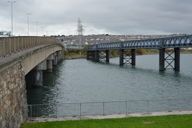
Laira Bridge is a disused railway bridge that crosses the River Plym in the city of Plymouth. The bridge was refurbished to carry a pedestrian and cycle path, which opened in 2015.
The name is also used to refer to the road bridge that runs alongside and carries the A379 road.
Wikipedia: Link
 Map © Crown Copyright")
TIP: Click the map for more Large scale mapping
- Grid Square
- SX5054, 134 images (more nearby 🔍)
- Photographer
- N Chadwick (more nearby)
- Date Taken
- Saturday, 24 October, 2015 (more nearby)
- Submitted
- Sunday, 28 February, 2016
- Subject Location
-
OSGB36:
 SX 5013 5422 [10m precision]
WGS84: 50:22.1246N 4:6.5243W - Camera Location
-
OSGB36: SX 5021 5419
- View Direction
- West-northwest (about 292 degrees)