2015
SX5054 : National Cycle Route 27 signpost
taken 8 years ago, near to Turnchapel, Plymouth, England
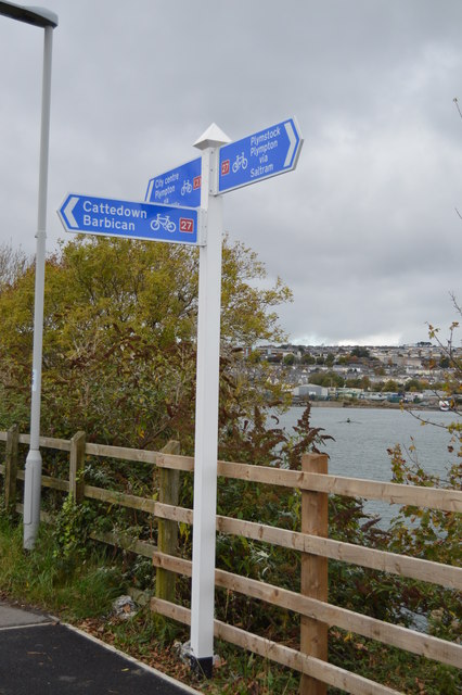
National Cycle Route 27 signpost
National Cycle Network Route 27 is a 99 miles long route between Ilfracombe and Plymouth, of which 71 miles are traffic-free. The route combines the beaches and estuaries of North Devon with the lush green valleys of the Torridge, the Tavy, the Walkham and other evocative West Country rivers. The route also skirts round the western flank of Dartmoor offering superb views of Cornwall and the surrounding area. There is also many local links and spurs to explore. Largely tracing the course of former railway lines, the route takes you through tunnels and across the breathtaking viaducts and bridges bequeathed by Victorian railway engineers.
See other images of National Cycle Network Route 27
See other images of National Cycle Network Route 27
 Map © Crown Copyright")
TIP: Click the map for more Large scale mapping
- Grid Square
- SX5054, 134 images (more nearby 🔍)
- Photographer
- N Chadwick (more nearby)
- Date Taken
- Saturday, 24 October, 2015 (more nearby)
- Submitted
- Wednesday, 2 March, 2016
- Subject Location
-
OSGB36:
 SX 5001 5430 [10m precision]
WGS84: 50:22.1659N 4:6.6274W - Camera Location
-
OSGB36: SX 5002 5429
- View Direction
- North-northeast (about 22 degrees)