2007
SZ0691 : The boundary
taken 17 years ago, near to Branksome, Bournemouth, Christchurch & Poole, England
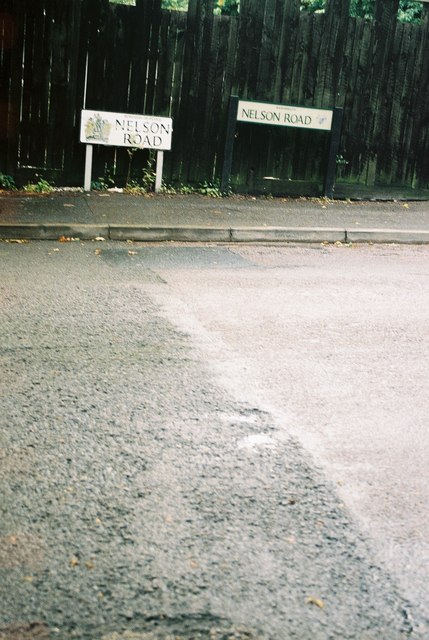
The boundary
This is the point where Bournemouth becomes Poole. The sign on the right is a Bournemouth one; the one on the left is a Poole one. You can see the join in the road where one council has done resurfacing work up to the limit of their jurisdiction.
 Map © Crown Copyright")
TIP: Click the map for more Large scale mapping
- Grid Square
- SZ0691, 112 images (more nearby 🔍)
- Photographer
- Chris Downer (more nearby)
- Date Taken
- Tuesday, 3 July, 2007 (more nearby)
- Submitted
- Wednesday, 4 July, 2007
- Subject Location
-
OSGB36:
 SZ 067 918 [100m precision]
WGS84: 50:43.5740N 1:54.3100W