2016
NU2521 : South Mere, Dunstanburgh Castle
taken 8 years ago, near to Craster, Northumberland, England
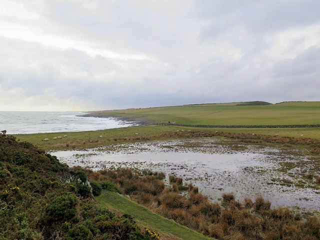
South Mere, Dunstanburgh Castle
It was at one time believed that the South Mere was connected to the sea and formed an artificial harbour for the castle. There is no evidence that this was the case as it is less than 1m in depth. The bay of Nova Scotia (visible behind the natural storm beach which forms a causeway to the castle) was modified to provide a small harbour although it is poorly protected from strong south-easterly winds.
The South Mere is connected to the West Mere by a ditch and they are maintained by the National Trust to provide a habitat for birds and amphibians. Water levels can be regulated by a brick-built manhole, into which water can overflow into an underlying drain, which discharges into Nova Scotia bay.
The South Mere is connected to the West Mere by a ditch and they are maintained by the National Trust to provide a habitat for birds and amphibians. Water levels can be regulated by a brick-built manhole, into which water can overflow into an underlying drain, which discharges into Nova Scotia bay.
 Map © Crown Copyright")
TIP: Click the map for more Large scale mapping
- Grid Square
- NU2521, 528 images (more nearby 🔍)
- Photographer
- Andrew Curtis (more nearby)
- Date Taken
- Friday, 4 March, 2016 (more nearby)
- Submitted
- Friday, 4 March, 2016
- Subject Location
-
OSGB36:
 NU 2578 2140 [10m precision]
WGS84: 55:29.1439N 1:35.6167W - Camera Location
-
OSGB36: NU 25781 21471
- View Direction
- SOUTH (about 180 degrees)