2016
NU2521 : Site of Pen Pond below Scrog Hill
taken 8 years ago, near to Dunstan, Northumberland, England
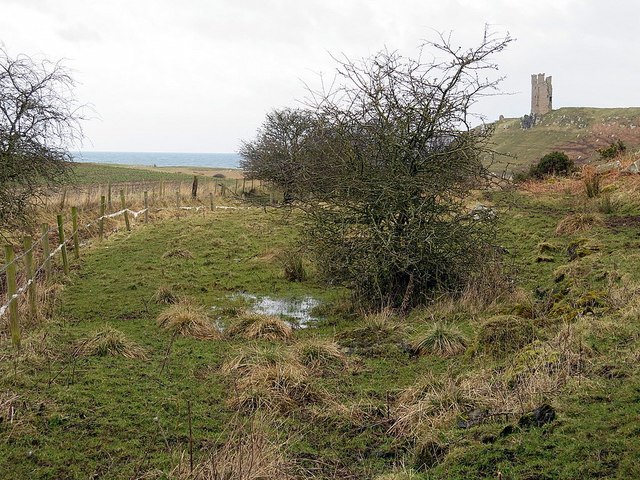
Site of Pen Pond below Scrog Hill
The low-lying area beside the modern ditch was a former pond created by a dam across a small watercourse, fed by a natural spring and appears to have been part of the water supply for the meres west of Dunstanburgh Castle. An old overflow channel which discharged directly into the sea can be traced into the arable field on the left where it has been ploughed out, but appears again as an earthwork along the north-west part of the North Mere. An embankment on its east side contained water in the mere. Water for the former fishponds, the West and South Meres was conveyed though an artificial stone-lined channel, partly underground, in an easterly direction along the base of Scrog Hill NU2521 : Former water channel below Scrog Hill
Dunstanburgh Castle, Northumberland: Archaeological, Architectural and Historical Investigations by Al Oswald, Jeremy Ashbee, Katrina Porteous and Jacqui Huntley. English Heritage (2006).
Dunstanburgh Castle, Northumberland: Archaeological, Architectural and Historical Investigations by Al Oswald, Jeremy Ashbee, Katrina Porteous and Jacqui Huntley. English Heritage (2006).
 Map © Crown Copyright")
TIP: Click the map for more Large scale mapping
- Grid Square
- NU2521, 528 images (more nearby 🔍)
- Photographer
- Andrew Curtis (more nearby)
- Date Taken
- Friday, 4 March, 2016 (more nearby)
- Submitted
- Saturday, 5 March, 2016
- Subject Location
-
OSGB36:
 NU 2525 2158 [10m precision]
WGS84: 55:29.2426N 1:36.1189W - Camera Location
-
OSGB36: NU 25245 21563
- View Direction
- North-northeast (about 22 degrees)