2016
ST6460 : Bridleway north of Barrow Vale
taken 8 years ago, near to Farmborough, Bath And North East Somerset, England
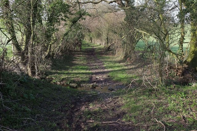
Bridleway north of Barrow Vale
At the same place where ST6460 : In a bridleway north of Barrow Vale was taken, with a tributary of the Conygre Brook crossing the track (bridleway CL 9/49), which climbs, muddily and slipperily, up the increasing slope beyond.
 Map © Crown Copyright")
TIP: Click the map for more Large scale mapping
- Grid Square
- ST6460, 28 images (more nearby 🔍)
- Photographer
- Derek Harper (more nearby)
- Date Taken
- Tuesday, 16 February, 2016 (more nearby)
- Submitted
- Wednesday, 9 March, 2016
- Subject Location
-
OSGB36:
 ST 6475 6070 [10m precision]
WGS84: 51:20.6569N 2:30.4489W - Camera Location
-
OSGB36: ST 6476 6069
- View Direction
- Northwest (about 315 degrees)