2016
TG1208 : A lot of water under the bridge
taken 8 years ago, near to Marlingford, Norfolk, England
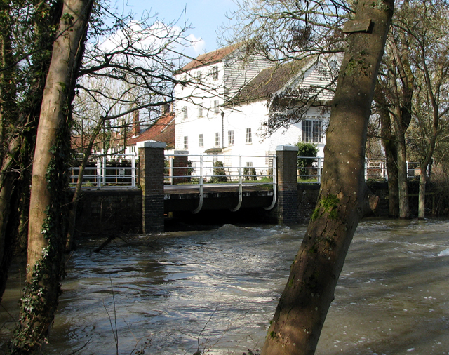
A lot of water under the bridge
After a day of non-stop rain the River Yare is carrying a lot of water and has flooded adjacent pastures. The watermill at Marlingford is the building seen in the background.
 Map © Crown Copyright")
TIP: Click the map for more Large scale mapping
- Grid Square
- TG1208, 125 images (more nearby 🔍)
- Photographer
- Evelyn Simak (more nearby)
- Date Taken
- Thursday, 10 March, 2016 (more nearby)
- Submitted
- Thursday, 10 March, 2016
- Subject Location
-
OSGB36:
 TG 1284 0834 [10m precision]
WGS84: 52:37.8635N 1:8.6183E - Camera Location
-
OSGB36: TG 1292 0830
- View Direction
- West-northwest (about 292 degrees)