2007
NY1278 : Castlehill
taken 17 years ago, 3 km from Kettleholm, Dumfries And Galloway, Scotland
This is 1 of 3 images, with title Castlehill in this square
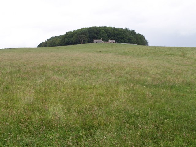
Castlehill
The plantation behind the hilltop farm contains two circular settlement sites, presumably Iron Age. The view is from the corner of Fox Covert, at the edge of Birkshaw Forest.
 Map © Crown Copyright")
TIP: Click the map for more Large scale mapping
- Grid Square
- NY1278, 8 images (more nearby 🔍)
- Photographer
- Derek Harper (more nearby)
- Date Taken
- Wednesday, 4 July, 2007 (more nearby)
- Submitted
- Thursday, 5 July, 2007
- Subject Location
-
OSGB36:
 NY 1229 7857 [10m precision]
WGS84: 55:5.6264N 3:22.5535W - Camera Location
-
OSGB36: NY 1227 7811
- View Direction
- NORTH (about 0 degrees)