2007
SE0206 : Stone structure, Saddleworth
taken 17 years ago, near to Diggle, Oldham, England
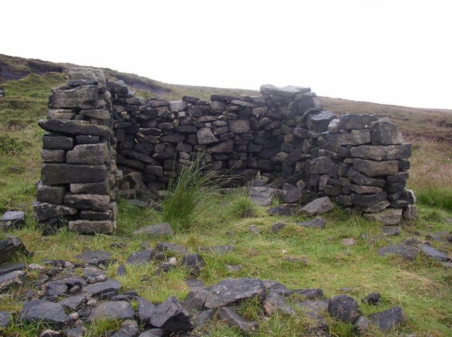
Stone structure, Saddleworth
A hide for shooting grouse or a ruined shelter? This is alongside the disused water channel.
 Map © Crown Copyright")
TIP: Click the map for more Large scale mapping
- Grid Square
- SE0206, 32 images (more nearby 🔍)
- Photographer
- Humphrey Bolton (more nearby)
- Date Taken
- Thursday, 5 July, 2007 (more nearby)
- Submitted
- Thursday, 5 July, 2007
- Subject Location
-
OSGB36:
 SE 025 069 [100m precision]
WGS84: 53:33.5230N 1:57.8239W - Camera Location
-
OSGB36: SE 025 069
- View Direction
- Southwest (about 225 degrees)