2007
SP2976 : Old smithy, Kirby Corner
taken 17 years ago, near to Westwood Heath, Coventry, England
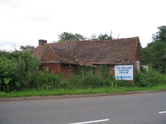
Old smithy, Kirby Corner
Not necessarily the best advertisement, one would have thought! This building is shown as a smithy on old 1:10560 Ordnance Survey maps (1887,1905,1925 and 1938). There is a yard behind, containing roofing/building materials, which was shown as a brickworks on 1887 and 1905 maps and saw mill on 1925 and 1938 maps. The road in the foreground is Westwood Heath Road.
 Map © Crown Copyright")
TIP: Click the map for more Large scale mapping
- Grid Square
- SP2976, 73 images (more nearby 🔍)
- Photographer
- E Gammie (more nearby)
- Date Taken
- Friday, 6 July, 2007 (more nearby)
- Submitted
- Friday, 6 July, 2007
- Subject Location
-
OSGB36:
 SP 293 762 [100m precision]
WGS84: 52:23.0316N 1:34.1950W - Camera Location
-
OSGB36: SP 293 763
- View Direction
- South-southwest (about 202 degrees)