2016
TQ2250 : Pond off Lawrence Lane
taken 8 years ago, near to Buckland, Surrey, England
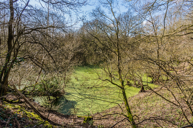
Pond off Lawrence Lane
Former sandpit off Lawrence Lane, now flooded and algae covered. Maps suggest that this is the oldest of the sand quarrying operations in the Buckland area, which started in 1925 and over time extended to various sites either side of the Reigate Road before extraction from the final one, Tapwood Pit, finally ceased in August 2014.
 Map © Crown Copyright")
TIP: Click the map for more Large scale mapping
- Grid Square
- TQ2250, 293 images (more nearby 🔍)
- Photographer
- Ian Capper (more nearby)
- Date Taken
- Friday, 4 March, 2016 (more nearby)
- Submitted
- Sunday, 20 March, 2016
- Subject Location
-
OSGB36:
 TQ 226 509 [100m precision]
WGS84: 51:14.6816N 0:14.6233W - Camera Location
-
OSGB36: TQ 227 509
- View Direction
- Southwest (about 225 degrees)