2012
SH4356 : Boncan Dinas from the southeast
taken 12 years ago, near to Llandwrog, Gwynedd, Wales
This is 1 of 2 images, with title starting with Boncan in this square
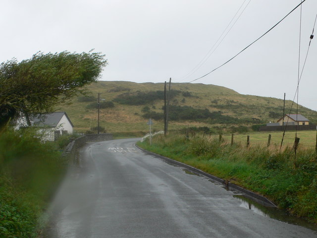
Boncan Dinas from the southeast
An Iron Age Hillfort known as Boncan Dinas (Dinas Mound). It was also occupied by the Romans as Roman pottery has been found here.
 Map © Crown Copyright")
TIP: Click the map for more Large scale mapping
- Grid Square
- SH4356, 66 images (more nearby 🔍)
- Photographer
- Eirian Evans (more nearby)
- Date Taken
- Friday, 17 August, 2012 (more nearby)
- Submitted
- Friday, 25 March, 2016
- Subject Location
-
OSGB36:
 SH 437 563 [100m precision]
WGS84: 53:4.8866N 4:20.0615W - Camera Location
-
OSGB36: SH 439 562
- View Direction
- Northwest (about 315 degrees)