2016
SE1345 : Green Crag
taken 8 years ago, 3 km from Ilkley, Bradford, England
This is 1 of 3 images, with title Green Crag in this square
Green Crag
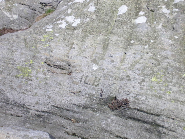
This rock used to be on the parish boundary but the line has now changed. It is inscribed ILB for Ilkley Local Board and a date which could be 1893.
There is also a larger and fainter marking which seems to be WM 1785 although it is difficult to decipher with certainty.
Similar marking are on at least one other boundary stone at SE0846 : Boundary stone
There is also a larger and fainter marking which seems to be WM 1785 although it is difficult to decipher with certainty.
Similar marking are on at least one other boundary stone at SE0846 : Boundary stone
 Map © Crown Copyright")
TIP: Click the map for more Large scale mapping
- Grid Square
- SE1345, 28 images (more nearby 🔍)
- Photographer
- John Illingworth (more nearby)
- Date Taken
- Thursday, 31 March, 2016 (more nearby)
- Submitted
- Friday, 1 April, 2016
- Subject Location
-
OSGB36:
 SE 1335 4584 [10m precision]
WGS84: 53:54.5128N 1:47.8964W - Camera Location
-
OSGB36: SE 1335 4584
- View Direction
- NORTH (about 0 degrees)