2016
SO3168 : Stonewall Hill, South of Knighton, Powys. March 2016
taken 8 years ago, near to Norton, Powys, Wales
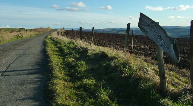
Stonewall Hill, South of Knighton, Powys. March 2016
The lane across Stonewall Hill from Knighton to Presteigne. This section marks the border between England and Wales, Herefordshire and Powys - England/Herefordshire to the left in this picture looking South with the Black Mountains above Hay-on-Wye in the far distance.
 Map © Crown Copyright")
TIP: Click the map for more Large scale mapping
- Grid Square
- SO3168, 21 images (more nearby 🔍)
- Photographer
- Peter Evans (more nearby)
- Date Taken
- Wednesday, 30 March, 2016 (more nearby)
- Submitted
- Sunday, 3 April, 2016
- Subject Location
-
OSGB36:
 SO 3169 6880 [10m precision]
WGS84: 52:18.7824N 3:0.2070W - Camera Location
-
OSGB36: SO 3171 6887
- View Direction
- SOUTH (about 180 degrees)