2016
NZ1262 : South Lodge, Bradley Hall
taken 8 years ago, near to Crawcrook, Gateshead, England
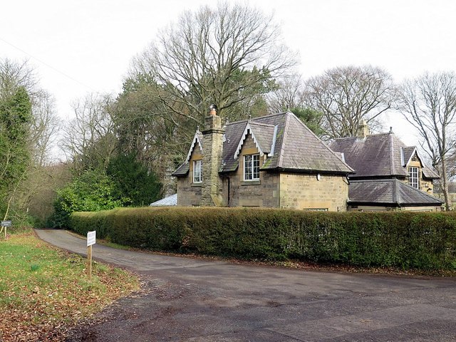
South Lodge, Bradley Hall
Bradley Hall has two main entrances, both with lodges probably of mid to late C19 date which are not shown on the 1857 OS map. On the north side of the site a drive runs south from Sled Lane; North Lodge lies on the east side of the drive c100m south of the entrance gate. The drive continues south through woodland, with Bradley Dene immediately to the east, to the Hall and stables, as shown on the 1857 OS map. On the south side of the site South Lodge is located beside a gated entrance from which a drive, not shown on the 1857 OS map, runs north to join with the north drive.
Parks & Gardens UK: Link (Archive Link )
Parks & Gardens UK: Link
 Map © Crown Copyright")
TIP: Click the map for more Large scale mapping
- Grid Square
- NZ1262, 13 images (more nearby 🔍)
- Photographer
- Andrew Curtis (more nearby)
- Date Taken
- Saturday, 12 March, 2016 (more nearby)
- Submitted
- Sunday, 3 April, 2016
- Subject Location
-
OSGB36:
 NZ 1249 6281 [10m precision]
WGS84: 54:57.5863N 1:48.3888W - Camera Location
-
OSGB36: NZ 12472 62799
- View Direction
- Northeast (about 45 degrees)