2016
SZ2993 : WWII inland defences of SW Hampshire - Everton pillbox (2)
taken 8 years ago, near to Everton, Hampshire, England
WWII inland defences of SW Hampshire - Everton pillbox (2)
-
Pillbox (unclassified): DoB ID: S0012876
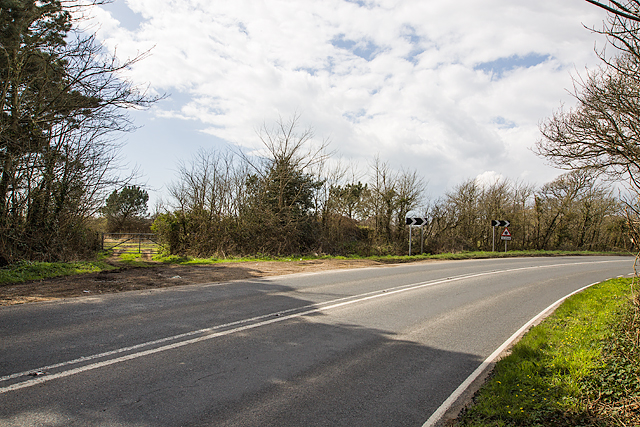
Today this pillbox remains totally hidden in the vegetation to the right of the farm gate (and to the immediate left of the first chevron) on a bend in the main road between Lymington and Barton-on-Sea. Part of the network that extended inland from the coastal defences centred on Taddiford Gap to the south.
SZ2694 : WWII inland defences of SW Hampshire - Ashley pillbox (1)
Pillbox (unclassified): DoB ID: S0012876
Today this pillbox remains totally hidden in the vegetation to the right of the farm gate (and to the immediate left of the first chevron) on a bend in the main road between Lymington and Barton-on-Sea. Part of the network that extended inland from the coastal defences centred on Taddiford Gap to the south.
SZ2694 : WWII inland defences of SW Hampshire - Ashley pillbox (1)
 Map © Crown Copyright")
TIP: Click the map for more Large scale mapping
- Grid Square
- SZ2993, 44 images (more nearby 🔍)
- Photographer
- Mike Searle (more nearby)
- Date Taken
- Tuesday, 5 April, 2016 (more nearby)
- Submitted
- Wednesday, 6 April, 2016
- Subject Location
-
OSGB36:
 SZ 2981 9393 [10m precision]
WGS84: 50:44.6530N 1:34.7321W - Camera Location
-
OSGB36: SZ 2983 9394
- View Direction
- West-southwest (about 247 degrees)