2016
ST7157 : Near Peasedown St John
taken 8 years ago, near to Shoscombe, Bath And North East Somerset, England
Near Peasedown St John
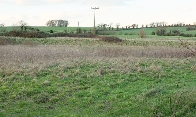
Looking north from Wellow Road towards the ring of trees on White Ox Mill Knoll. I get the impression that the bank-bounded site in the foreground has been earmarked as part of the spreading industrial estate on the south edge of Peasedown St John, but hasn't yet been developed.
 Map © Crown Copyright")
TIP: Click the map for more Large scale mapping
- Grid Square
- ST7157, 20 images (more nearby 🔍)
- Photographer
- Derek Harper (more nearby)
- Date Taken
- Tuesday, 23 February, 2016 (more nearby)
- Submitted
- Thursday, 7 April, 2016
- Subject Location
-
OSGB36:
 ST 7150 5718 [10m precision]
WGS84: 51:18.7807N 2:24.6174W - Camera Location
-
OSGB36: ST 7150 5701
- View Direction
- NORTH (about 0 degrees)