2016
TQ1814 : Copyhold Field
taken 8 years ago, near to Ashurst, West Sussex, England
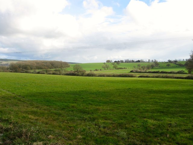
Copyhold Field
The name of the field according to Steyning's 1840 tithe map that has been merged with TQ1914 : Five Acres to the east to forma larger unit. To the west is TQ1814 : Cow Barn Field. Wyckham Wood is visible to the left.
 Map © Crown Copyright")
TIP: Click the map for more Large scale mapping
- Grid Square
- TQ1814, 62 images (more nearby 🔍)
- Photographer
- Simon Carey (more nearby)
- Date Taken
- Saturday, 9 April, 2016 (more nearby)
- Submitted
- Tuesday, 12 April, 2016
- Subject Location
-
OSGB36:
 TQ 1891 1448 [10m precision]
WGS84: 50:55.0524N 0:18.5855W - Camera Location
-
OSGB36: TQ 1891 1463
- View Direction
- SOUTH (about 180 degrees)