2016
NY1487 : Claydaubing Bridge
taken 8 years ago, near to Sibbaldbie, Dumfries And Galloway, Scotland
This is 1 of 2 images, with title Claydaubing Bridge in this square
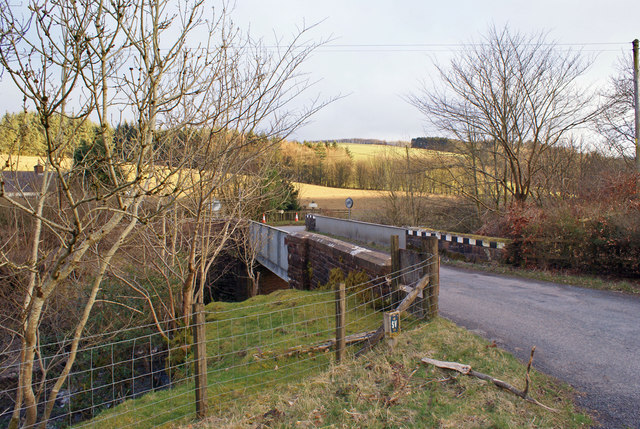
Claydaubing Bridge
From the road, at least, this looks more like a railway bridge, however, the bridge carries the B723 road over the Dryfe Water, just south of Sibbaldbie.
One has to wonder how the bridge came by its name.
One has to wonder how the bridge came by its name.
 Map © Crown Copyright")
TIP: Click the map for more Large scale mapping
- Grid Square
- NY1487, 11 images (more nearby 🔍)
- Photographer
- Richard Dorrell (more nearby)
- Date Taken
- Wednesday, 16 March, 2016 (more nearby)
- Submitted
- Wednesday, 13 April, 2016
- Subject Location
-
OSGB36:
 NY 1448 8746 [10m precision]
WGS84: 55:10.4412N 3:20.6561W - Camera Location
-
OSGB36: NY 1448 8743
- View Direction
- North-northwest (about 337 degrees)